MAP4D
A tool to visualize and accelerate interventions
In order to help emergency services and law enforcement agencies in their missions, we offer Map4D, an advanced virtual reality service capable of accelerating decision making.
3D visualization
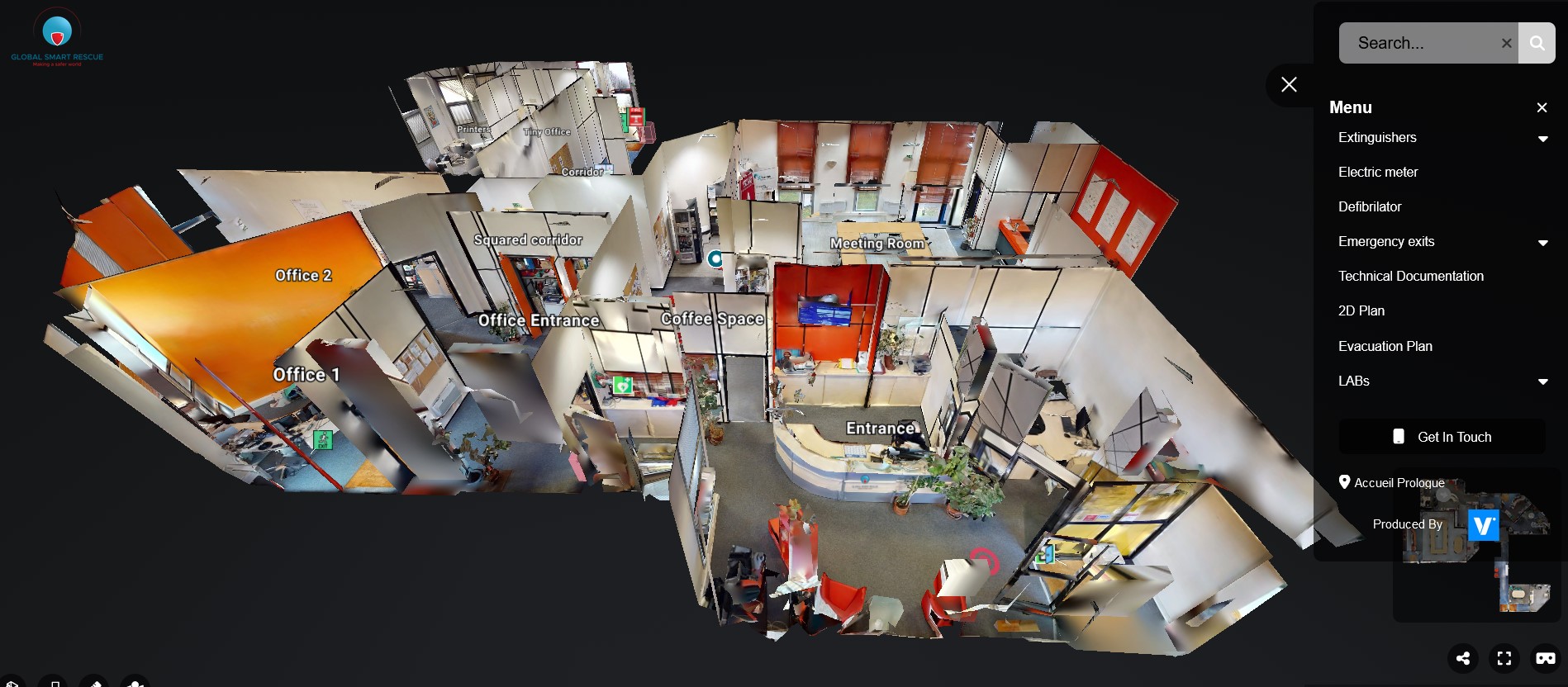
The 3D visualization of your infrastructure facilitates the intervention of emergency services and accelerates the repair process in case of insurance claims thanks to an accurate digitization of the entire premises and tags of tactical locations.
Benefits of MAP4D
Facilitated interventions
- Tag of the essential elements (emergency exits, fire extinguishers, electric meters, gas outlet...) - Easy to use navigation with schematic floor plan
One place = all information
Addition of detailed documentation (evacuation plan, gas circuit plan...)
Speed and precision
- Immersion with virtual helmet (before intervention, simulation of exercises, before/after insurance surveys). - Better reaction time in case of fire, accident or malicious damage.
How MAP4D works
Example Prologue digitization - Find all your digitized places in our data library. Navigate using the navigation buttons and the tag panel on the right

